Bridgeport Transportation and Land Use Study
The Bridgeport Transportation and Land Use Study seeks to enhance walkability, transportation, transit choices and neighborhood character within the 3.2 square mile study area in four municipalities of Lancaster County, PA. This plan builds upon Bridgeport’s history as an major gateway to the City of Lancaster and an important bridge crossing along the banks of the Conestoga River.
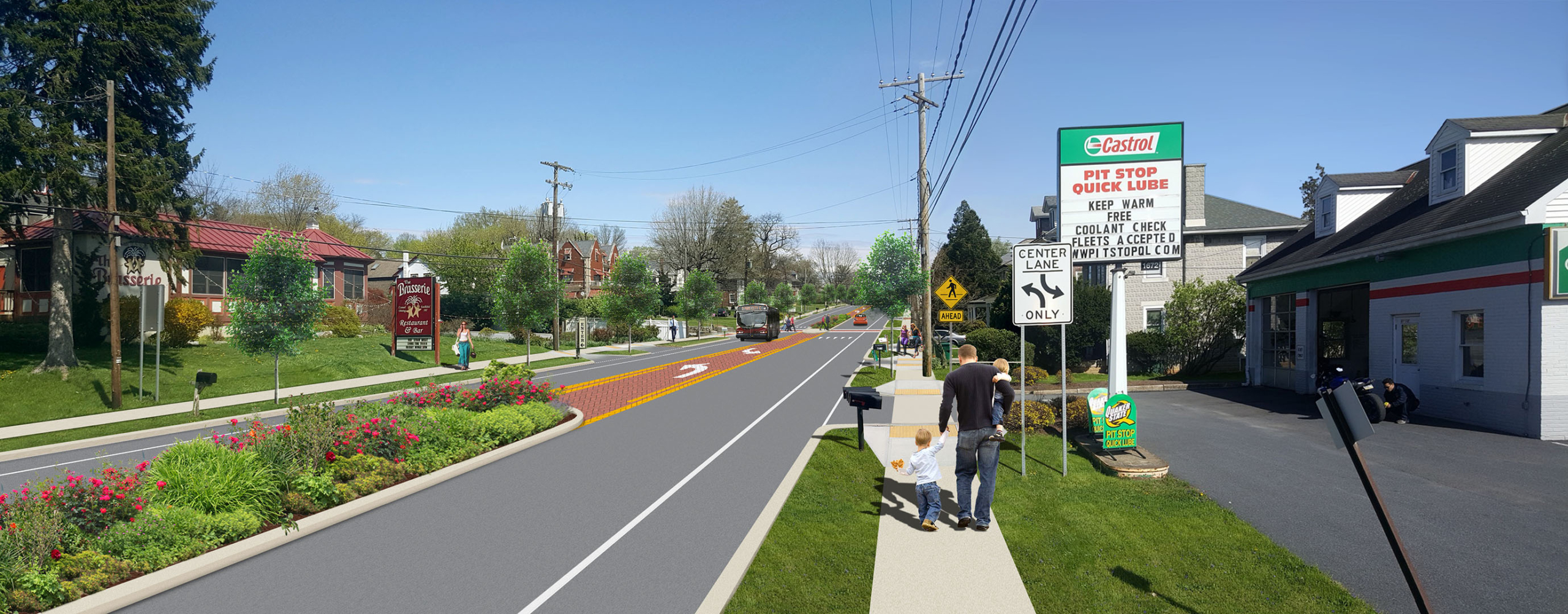
We have engaged over 500 people to understand the challenges and identify solutions for long-standing traffic congestion challenges, poorly coordinated land use patterns and a lack of sidewalks and trails. The study seeks to transform two of the County’s most important farm-to-market routes – Lincoln Highway and Old Philadelphia Pike into streets with better access for vehicles, bikes, pedestrians and the 5 regional bus routes. The plan has recommended major roadway improvements, a new mixed-use village, new streetscapes and trails, as well as funding strategies and zoning standards to help realize this vision.


